
See How Many Satellites Are Over Your Lawn Right Now
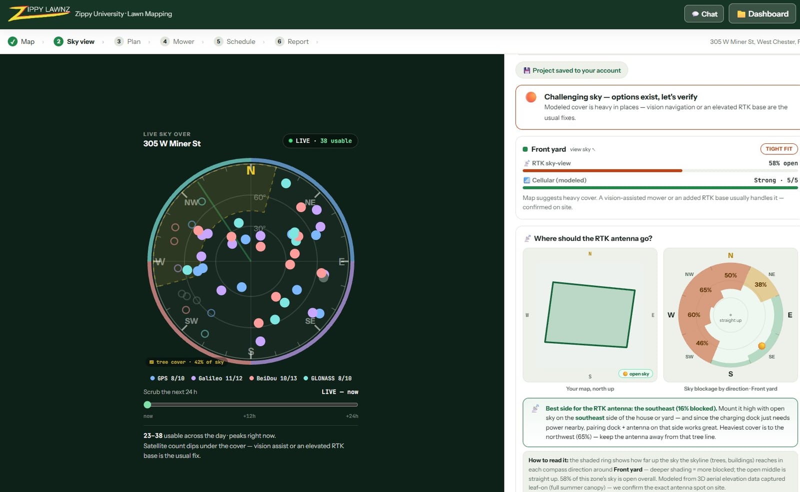
There are somewhere between 30 and 45 navigation satellites over your house right now. Your robot mower steers by them. Most people buy one without ever seeing that picture, so we built a free tool that shows it.
Open Sky View → — type an address, see your sky. No account, nothing saved.
What you’re looking at
The dial is the sky over your address, drawn the way an antenna sees it. The centre is straight up. The outer ring is the horizon. Every dot is a real navigation satellite, plotted by its compass direction and how high it sits, coloured by which system it belongs to:
- GPS — the American constellation, the one everybody names
- Galileo — the European system
- GLONASS — the Russian system
- BeiDou — the Chinese system, and now the largest of the four
Your mower tracks all of them at once. That’s why it can lose a dozen satellites behind a tree line and still know where it is to about an inch.
Drag the slider
The interesting part isn’t the number right now — it’s that the number moves. Navigation satellites orbit roughly twice a day, so the count over any fixed point rises and falls by ten or more across 24 hours.
Drag the time slider and watch your own curve. Most lawns never dip low enough to matter. But if your property is tight on sky to begin with, seeing where your daily low sits is genuinely useful: mowing outside it costs nothing and buys you a steadier fix.
What it deliberately doesn’t tell you
We could have made this tool claim more than it knows, and we’d rather not.
Sky View shows what’s above you. It cannot see what’s around you — your maple, your roof line, the neighbour’s garage. That half is specific to your yard rather than your town, and it’s usually the half that decides whether an install is easy or fussy. Two houses on the same street can behave completely differently.
That answer takes a scan of your actual property: reading the tree and roof line from satellite surface data to work out how much open sky each part of your lawn really has, and which side of the house the RTK antenna wants. We do that free when you map your lawn — it’s the same scan that tells us where to put the antenna on install day.
The rest of the picture
- How many satellites does a robot mower need? — the full explainer: why RTK needs two receivers, what four constellations buys you, and what tree cover actually takes away.
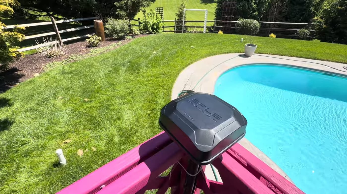
- Where to install your RTK antenna — the four rules, and the mistake that shows up as drift a season later.
- NetRTK vs local RTK — the other way to get corrections, and when it’s the better call.
See the satellites over your lawn → Free, no account, and the math runs in your own browser.
Frequently asked
Is the Sky View tool really free?
Yes. It needs no account and saves nothing. You type an address, and your own browser works out which navigation satellites are above it from public orbital data published by CelesTrak. There is no charge and no sign-up wall.
How accurate are the satellite positions?
They are a prediction from published orbits, using the same SGP4 model the rest of the industry runs on, and they are accurate to well under a degree. That is far more precision than an RTK-readiness picture needs. The orbital elements refresh daily.
Does this tell me if a robot mower will work at my house?
It answers half the question. The tool shows what is in the sky above you, which is the same for everyone in your town. It cannot see your trees or your roof — that is specific to your yard, and it takes a scan of your property to answer. Map your lawn and we run that scan free.
Do I need to enter my exact address?
No. Satellite geometry changes over hundreds of miles, not over a street, so any address in your town gives you the same picture. The exact address only starts to matter when we scan your tree line.
Keep reading
 GuideHow Many Satellites Does a Robot Mower Need?RTK mowers steer by GPS, Galileo, GLONASS and BeiDou. How many satellites your lawn needs, what tree cover takes away, and how to check your own sky for free.
 Installation & SetupWhere to Install Your Robot Mower's RTK Antenna (4 Rules)Mount your robot mower's RTK antenna wrong and it drifts after a season. The 4 rules of RTK placement — open sky, height, rigid mounting, and reflective surfaces.Installation & SetupNetRTK vs Local RTK on a Navimow: Which Should You Run?Every Navimow runs one of two correction paths: NetRTK over the internet, or your own base station's direct radio link. How each works and when to switch.
Explore the system
The mowers and pages behind this topic — see them sized to your yard.